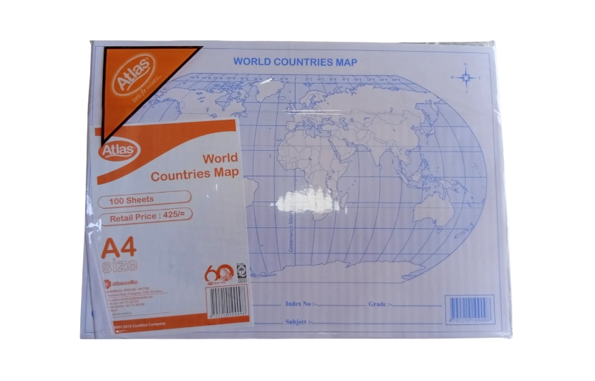
ATLAS WORLD COUNTRIES MAP | Atlas World Countries Map is a high-quality educational map printed on durable, laminated paper—ideal for students, teachers, and geography enthusiasts. Featuring vibrant colors and clear, detailed borders, country names, capitals, major cities, rivers, and mountain ranges, this map supports interactive learning and visual reference. Suitable for classroom display, home study, or office use. Order online now for fast and dependable delivery.